The Hole of Horcum

The Hole of Horcum
The Hole of Horcum and Levisham Moor, taken from the Whitby to Pickering road

Monday 28 April 2014

Springtime in The Okanagan Valley.

No blogs for the past week, been a little under the weather - now feeling better so catchup time with some photos from the last couple of weeks, mostly birds and the crazy weather over that time.
 A sunny day

A wet day, according to Wikipedia Oliver only gets 280mm of rain a year, I think most of that dropped this last couple of weeks.

 Hailstone!


 Bald Eagle sitting in one of the trees bordering the lake.

Red-winged Blackbird.


House Sparrow.


Amazing colouring on this Starling.

 
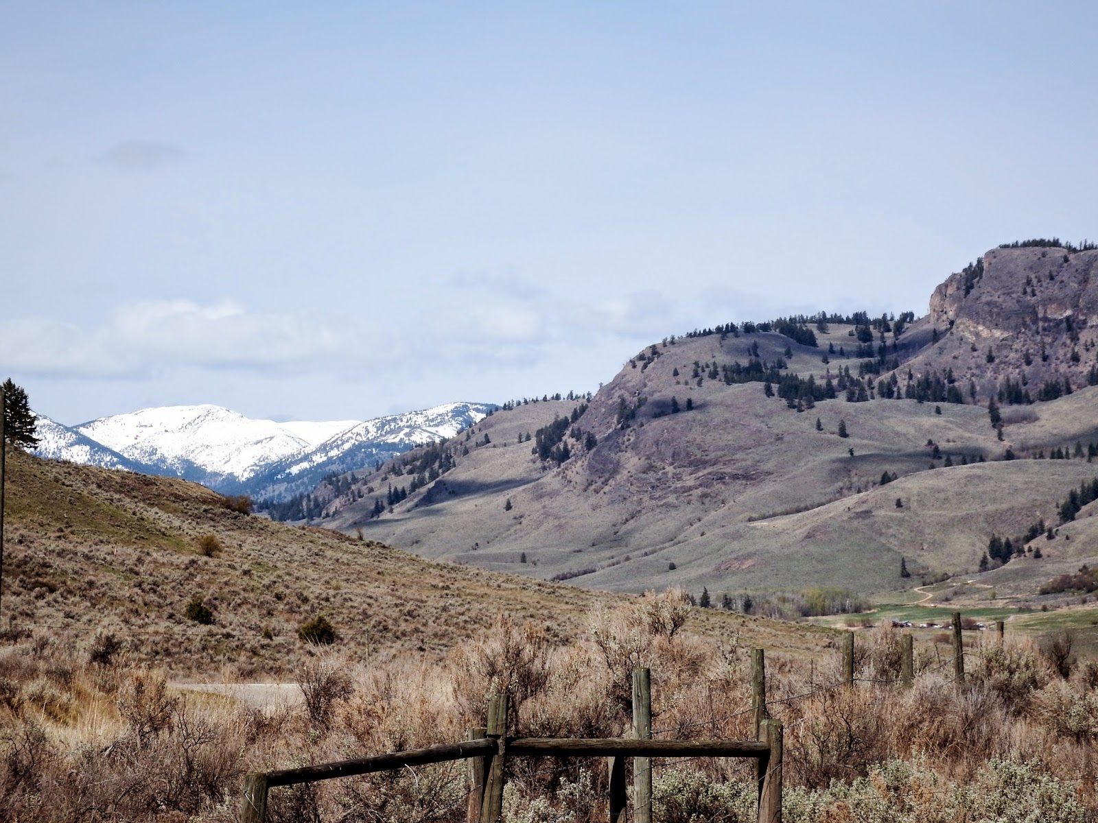
Sunny view taken on the road to White Lake, above the irrigated  Okanagan Valley, very dry desert landscape here.
California Quail 

A couple of Canada Geese in the woods  by the RV Park.

Evening view across Tuc-el-Nuit Lake.

Not sure what bird this is, we think a Swainsons Thrush?

White-crowned Sparrow

Song Sparrow in the turtle reeds by the side of the lake (have yet to see a turtle)
Killdeer.

All the photos of the birds have been taken here in the Apple Beach RV Park, Oliver all within 20 metres of our trailer, it is a wonderful place for lazy bird watching.Final photo today of a hillside above Oliver on Willowbrook Rd. showing more of the Okanagan sunflower.


Monday 21 April 2014

White Lake Basin Biodiversity Ranch.

After last nights rain this morning brought blue skies and sunshine, so off to visit White Lake, a short drive on the back roads from Oliver, up the valley to Fairview and along Willowbrook road and eventually arriving at White Lake in the hills above Okanagan Falls.
                                                                                   
 We didn't know quite what this place was all about before we arrived, really glad we went and if time permits we will try and come back for another visit, taking a picnic and my tripod, the different species of birds just along the track was amazing.

 Part of the canyon wall that protects the valley from the east.

Looking west towards the coastal mountains, not sure what these mountains are called, I think one may be Brent Mountain and the other Bromley Rock?

Our first sighting of a Western Meadow Lark.

Part of the working ranch
Enjoying the day.


Two more first sightings, a Mountain Bluebird and below a Western Bluebird


In the distance The White Lake Dominion Astrophysical Observatory, can't tell you any more about it, way above my head, all about solar fluxes and interferometric arrays and things, what ever they are!

Now I understand what this is - lots of pieces of wood placed just so, to keep cows in one place

 a lovely bluebell type of flower, can't find any reference to it.


Sunday 20 April 2014

Southern Okanagan & Similkaneen Valleys

Easter weekend here in Oliver, the weather is not co-operating, which seams to be the norm for this time of year, its not really cold or wet just grey and windy.  We are still getting out and about but I'm afraid the overcast skies don't help my photographic skills and I need all the help the sun gives. The picture above is Green Lake which is on a back road from Okanagan Falls to Oliver, lots of vines here as you can see, they call this the wine capital of Canada, not sure what the "viticulteurs" of Niagrara on the Lake have to say about that.

 These lovely yellow flowers are called Sunflowers of the Okanagan, Arrowleaf Balsamroot to the rest of the world.

Caught this American Robin standing on a fence.

This back road comes out at Fairview, which is the original settlement of Oliver. The town burnt down and was rebuilt a little lower down the valley.  By this time they had built dykes along the Okanagan River to control the flooding and discovered rich growing land which of course is a better long term bet than gold mines.


The border crossing at Osoyoos in the 1860s.

Another wall plaque explaining how the river system helped The Hudsons Bay Company Voyageurs move around the country.


The Okanagan Valley fro Fairview looking south towards Osoyoos.

Another little road trip, up the 97 to Kaleden down the 3A into The Similkaneen Valley to Keremaos along the 3 to Chopaka and Osoyoos and then back up the 97 to Oliver a trip of around 130km.
                                                                           
Piano Lake, interesting rock colours.


The Similkaneen River Valley.
The Spotting Lake just before the Richter Pass down into Osoyoos, the circles in the lake are formed by the different minerals in the water.

 View looking north over the Osoyoos Lake towards Oliver from the top of the Richter Pass. 

The view looking south towards Osoyoos from the same viewpoint.
As I wright this its started raining maybe we will have a better day tomorrow.


Tuesday 15 April 2014

Flea Market & Okanagan Valley scenery on the way to visit friends.

Weekend and a visit to the indoor flea market in Oliver, held in an old warehouse complex in Oliver every weekend, lots of stalls with interesting things, hard as we tried to get out without spending any money, it was not possible, but we have enough dvd's to last us for about three rainy days.


 We took the back road from Oliver to Osoyoos through the vineyards and fruit trees and passed these old buildings - The Haynes Ranch-
Not sure if they have been preserved or the are going to be?


Some of the stunning scenery in the southern part of the Okanagan Valley, the most northern part of the Sonoran Desert.
After the Okanagan River leaves Oliver it becomes marshland which they call the Osoyoos Oxbows and then into Osoyoos Lake.  We are going to explore this part of the world a bit more this next week, there is lots of bird life here.

The entrance to NK'Mip Campground alongside Osoyoos Lake where our friends Blair and Birgit from Alberta have spent the winter.
His and hers trucks.


 A couple of hours later after coffee and chatting we make take our leave, hope to see them again late spring - early summer in Alberta.